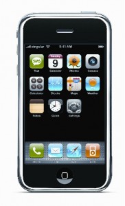
The day the cell phone became more than a phone, is the day I started to desire one. The phone itself, is my least favorite part of the device. In a nutshell, the IPhone is a movement toward a micro computer, and as such, is host to an abundance of software applications spawned in our binary age. I use my IPhone more and more in practical and functional ways, and a few particular applications are especially helpful when out on photo adventures. I thought I’d list a few of the applications I use and why I like them.
-
Stanza: Free
An E-book reader for the IPhone. What does this have to do with photography. It has nothing to do with the act of photography specifically, but everything in between. That includes the option to read stimulating books when waiting for sunset light, or standing in line at a myriad of poorly functional retail outlets with bad Fung Shui.
-
Planets: Free
Visual presentation of the night sky with planet visibility data. A very simple and easy to read/understand software with visual display of planets and their visibility status on a nice graph. Lists rise and set time of the planets as well.
-
Focalware: $10.00
Shows GPS linked sun and moon rise/set and time based location in the sky, including azimuth numbers. It is really nice for the fact that you can explore ahead in the calendar to see what the sun or moon is doing at a later day in the month. A great research tool especially valuable in Alaska with such variation in the sun’s presence. A powerful tool.
-
Shralp Tide: Free
If you are ever on the coast and forgot your tide book (like I always seem to do), this little app will give you tide information for many, although not all, US locations.
-
Pocket World Maps: $.99
In my travels I meet people from all over the world and it is convenient to have a little set of world maps to access in order to see where someone lives. This little App does that well, although and even deeper zoom capability would be nice.
-
Trainer Lite: Free
GPS based tracking program which logs hikes linked to google maps. Need WiFi or data to show map, but will log your route and save it for later viewing. Most interesting and annoying is the voice that speaks to you as you travel noting your distance traveled. The first time it spoke from backpack, it scared me, I was hiking in silence for a full mile in the arctic and then came a woman’s voice. One point zero miles!
-
GeoLives: Free
A little stepped up GPS trip mapper that lets you email your route which then links to view it plotted on Google Earth. Pretty cool.You can send someone your latest venture and invite them to see your journey in three dimensional Google earth.
-
Star Walk: $4.99
My all time favorite so far. Shows visual real time, GPS based constellation info when pointed at the sky, very, very cool program. Includes constellations, galaxies, date information for meteor showers, and other cool stuff. Get lost in this one, I learned more about the night sky in a few hours with this program than years of prior stargazing. You can even search for night sky subjects and it will locate them for you.
-
EZ level: $.99
For parking my van on level ground when selecting a camp spot.
-
WordBook Dictionary: Free
If you are too far from a dictionary, well, you are too far.
-
WordRoll English/Spanish dictionary: Free
I’m headed to south America soon. Quick access to elusive Spanish words.
-
Ibirder Pro: $29.00
A bird book with sounds, pictures, range, and other information. It wont replace a bird book completely, but is amazing. In particular the similar tab will list birds that are similar with the one your are viewing. The sound recordings are very clean. A fantastic tool when in the field. I used it often on a 10 day river trip in Alaska’s arctic this summer, and continue to use it both around the homeland and when traveling. Even my 3 year old nephew likes it. He wants to hear more birds. His favorite is the American Bittern, if you have ever heard one before, you will know why.
-
TweetDeck: Free
If you are a twitter socialphite.
-
Amazon Kindle for IPhone: Free
An E-book reader, although I like Stanza better, this will sync with your Kindle books if you have an account with Amazon.
-
DOF Master: $1.99
Calculator for quickly finding Hyperfocal Distance per lens and and f/stop. I use it for reference, but the whole subject of HD is a complex and seemingly imperfect one for absolute accurate focus. You can either buy a $4000. Tilt shift lens from Canon or take two frames at varying focal points and Open as Layers/Image align/gradient tool blend, in Photoshop and get a better file and it is a whole lot cheaper.
So now that you have drained the battery by using of all these apps, here is a solution to charging when in remote areas, off the power grid:
A USB Solar charger: Most devices charge in 2-4 hours, using a USB port. I used a similar version to charge my IPhone once and it worked fine. I’m not positive about the time to charge a fully dead battery. It is lightweight and you can strap it easily to the back of a backpack and charge your device while hiking on a sunny day. I do a lot of travel that is off the power grid so one of these is critical. $$115.00 at REI
I’m sure there are other apps out there that serve a fitting purpose in the photo-working-world, I’d be curious to hear of one that you find particularly useful.
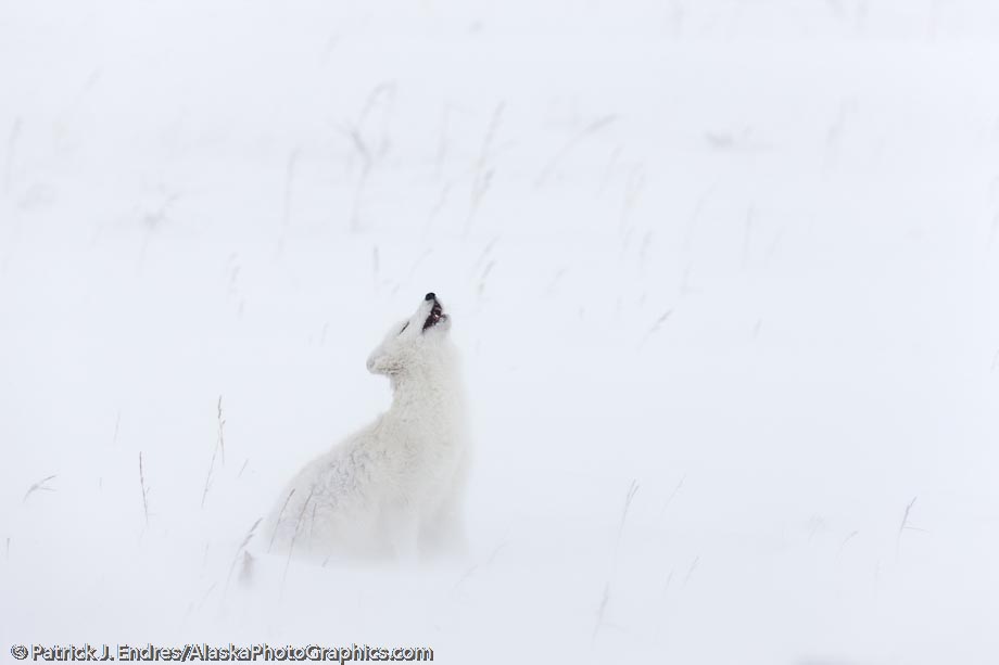
If you could care less about an Iphone and came here to look at pictures, I’m including this one just for you.

Arctic fox in a ground blizzard on Alaska's arctic north slope. The fox is looking up because a flock of 8 ravens were trying to steal a piece of meat that it was desperately trying to burry. It was a grab shot from the window of a vehicle with winds about 35mph. Getting initial focus was tough due to all the white and lack of contrast for the camera focus sensors to hit on. But it locked on for a few frames. Canon 1Ds Mark III, 500mm f/4L IS, 1/500 sec @ f/9, ISO 800.


